


Successes in Stewardship: November 2003 |
|---|

|
Federal Highway Administration
November 2003
Geographic Information Systems and Data-Sharing: Mapping the Future of Transportation
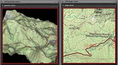
Geographic Information Systems (GIS) technology can effectively streamline all phases of the transportation project development process. Environmental data, when incorporated in GIS, are often used to describe and illustrate real world information. The data can depict the presence of natural, cultural and historical resources, as well as other ecosystem and societal characteristics. Such data benefits state Departments of Transportation (DOTs) by allowing better planning of proposed projects, while also assisting in the decisionmaking and environmental impact analysis of projects. The completion of environmental requirements during project development, as well as the evaluation of contractor performance and compliance during construction and maintenance, can be better organized by utilizing GIS information. For these reasons, GIS data-sharing among Federal, state, tribal, and local governments, as well as private companies, nonprofit organizations, and academia can serve as an effective tool, leading to increased program efficiency and cost savings for state DOT projects.
By sharing environmental data among agencies and organizations, states can create an integrated database for project planning and review. Data-sharing allows agencies to focus their time, expertise, and finances on managing the specific resources for which they are responsible, ultimately leading to a more current, accurate, and generally improved quality of data. Agencies are no longer responsible for updating and managing all related records. Both time and costs are saved by not duplicating the data collection and maintenance efforts. Data-sharing also leads to an enhanced understanding of projects by allowing stakeholders access to all project-related data. An integrated database serves as the foundation for streamlined decisionmaking because it ensures that agencies are all reviewing the same information. Miscommunication among partners can thus be avoided and projects can advance more quickly without confusion or lack of information.
The Benefits of Data-Sharing
|
Partnerships for the purpose of data coordination are based on agencies' clear communication of the goals and responsibilities necessary for developing an effective database and GIS application. In order to create a successful system, there must be buy-in from all agencies involved; this substantiates the value of the relationship among the partners. A multi-disciplinary team of experts, including information management specialists and professionals in the fields in which data will be used, should be relied upon to identify problems and solutions in the development and implementation of the database. While states can vary their approach in developing data coordination, all groups must contribute equally to the functioning of the database in order to fully apply the data. In addition, DOTs and partnering agencies must recognize the need for confidentiality as a means to protect specific resources such as endangered species or historic properties. Staff must be trained and proficient in GIS, and data must be updated continuously to maintain its accuracy. These practices will result in the preservation of valuable natural resources, as well as time and money.
GIS Data ClearinghousesGeospatial One-Stop Bureau of Transportation Statistics National Spatial Data Infrastructure Geospatial Data Clearinghouse |
The Indiana DOT (INDOT), in association with Bernardin, Lochmueller & Associates, Incorporated and the Indiana Geological Survey, is currently compiling a GIS application for use during NEPA project development and as a long-range transportation-planning tool. The application includes over 170 different geospatial data layers, ranging from environmental resources to socio-economic, historical, and geologic feature data. This GIS application was first applied in southwestern Indiana as a resource for completing a Tier 1 EIS for the Interstate-69 Project. The data coordination effort was so effective that statewide expansion of the GIS was planned, and will be completed in late 2003 or early 2004. Data was originally selected from several state and Federal agencies and then edited and formatted to create the southwestern Indiana GIS. This system is currently available free of charge to all state and Federal agencies and the public for use in any future project. The Indiana GIS System is an example of data-sharing and collaboration that when fully implemented and utilized will not only streamline future project development, but also reduce staff workload and fiscal demands. For more information on Indiana's GIS visit: http://igs.indiana.edu/arcims/index.html.
The Florida DOT's Efficient Transportation Decision Making (ETDM) process creates linkages among land use, transportation, and environmental resource planning initiatives through early, active, and continuous agency and community involvement. ETDM identifies critical issues as early as the planning phase to reduce conflicts among permitting agencies. The process uses state-of-the-art technologies including GIS and Web-based communication tools to allow team members to communicate more effectively. Technologies such as these will improve decisionmaking and have the potential to greatly reduce the time, effort, and cost required to implement transportation plans, while helping to protect the human and natural environment. The process uses interagency teams to coordinate transportation project reviews within their respective agencies, ensuring agency interaction throughout a project's lifetime. By providing an easily accessible information mechanism to sponsoring agencies and the public, improvements can be made to the planning, scoping, permitting, evaluation and feedback processes associated with transportation decisionmaking. For more information on Florida's ETDM visit: http://www.dot.state.fl.us/emo.
Washington State and Washington State DOT (WSDOT) have become national leaders in the development of innovative methods of sharing geographic data. One such method is the Environmental GIS Workbench, managed by WSDOT's Environmental Information Program (EIP). The Environmental Workbench is a custom-built GIS application designed to allow transportation agency staff access to a broad range of statewide environmental and natural resource management data. The EIP supports the GIS tool by coordinating with numerous Federal, state, and local agencies to ensure that datasets are continuously updated and remain accurate. The digitized data layers are available as ArcView readable files and may be easily downloaded, overlaid, and manipulated. The project has seen promising results. The increased availability of information has reduced decision review time, while centralized control of the system by EIP continues to maintain and improve data accuracy. For more information on Washington's Environmental Workbench visit: http://www.wsdot.wa.gov/Environment/GIS/workbench.htm
Useful GIS WebsitesGIS.com — web portal for general GIS information on the web; maintained by ESRI (developer of the ArcView and ArcGIS mapping software). Guide to GIS Resources — comprehensive website containing information on tutorials, user assistance, terminology, and data resources. Creating a Statewide Spatial Data Repository and GIS Data Cooperative — example from New York State about how to effectively share data statewide. National Highway Institute course "Applying Spatial Data Technologies to Transportation." |
Contact InformationAung Gye |
|
"Successes in Stewardship" is a Federal Highway Administration newsletter highlighting current environmental streamlining practices from around the country. To subscribe, call (617) 494-6352 or email esnewsletter@volpe.dot.gov. |