


Successes in Stewardship: March 2002 |
|---|
 Topics: Interstate Highway System
|
Federal Highway Administration
March 2002
Resource Mapping and Early Involvement: Arkansas' Southeast Connector to Interstate 69
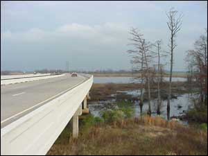
Interstate Facility in Southeast Arkansas & Northern Terminus of Southeast Arkansas I-69 Connector
Overview of SuccessThe development of Interstate 69 (I-69), the proposed north-south interstate from Canada to Mexico, will encompass many projects and involve many local, state, and Federal agencies. One such project in Arkansas, the Southeast Arkansas Connector (SE-Connector), will ultimately connect I-69 to the existing Arkansas interstate highway system. The use of innovative technology and early coordination with resource agencies, the public, and Native American tribes expedited the NEPA review process. The SE-Connector, the first of three I-69 projects in Arkansas, will improve travel flow, safety, and capacity. It will also improve emergency vehicle response times and vehicle access to medical, educational, and recreational facilities. In addition to providing relief to Interstate 30 and Interstate 40 in Arkansas, which are experiencing heavy truck traffic between Mexico and south Texas, the SE-Connector will accommodate local and regional economic growth. GIS MappingThe Arkansas State Highway and Transportation Department (AHTD) used Geographic Information Systems (GIS) technology to streamline the transportation decision-making and permitting process for the SE-Connector. GIS technology helps project sponsors and reviewers consolidate environmental and engineering data, refine the study area in order to focus review efforts, and screen project alternatives efficiently. Participating agencies and affected communities were able to select an alternative with minimal impacts to wetlands, farmland soils, archaeological resources, businesses, churches, and other community properties and natural and cultural resources, which were also mapped. "The GIS process allowed for alternatives to be effectively and efficiently evaluated in response to public or agency comments," explains Lynn P. Malbrough of the AHTD. "The subtle differences in the study corridors and project alignments were consistently compared and evaluated. The public and resource agencies were well informed with both the graphical and tabular presentations of the environmental constraints and how the proposed alignments related to these constraints." GIS technology has also been used successfully in other states, including Florida, Louisiana, Mississippi, Alabama, and Texas. AHTD and the Federal Highway Administration (FHWA) Arkansas Division hope to expand their use of GIS by participating in the newly formed Federal GIS Users Group comprised of Federal agencies within Arkansas. Group meetings present a forum for agencies to share GIS data, discuss projects that may affect other participating agencies, and reduce duplications in data gathering. Early Resource Agency and Public InvolvementEarly involvement with resource agencies and the public expedited the SE-Connector development process. AHTD was able to work effectively with the FHWA Arkansas Division to conduct scoping meetings, which offered the public the opportunity to help select the appropriate corridor. AHDT and FHWA's early coordination with resource agencies resulted in the development of a Section 106 Programmatic Agreement with state and Federal preservation offices and local Native American tribes. The use of GIS fostered information sharing among agencies and public involvement. GIS maps illustrating constraints helped resource agencies review project alternatives and participate in project development. Early resource agency and public involvement prevented surprises in the SE-Connector planning process that could have potentially delayed the project and increased costs. In addition, community and environmental needs were better met. Programmatic Agreements with Native American TribesExtra effort was made to develop programmatic agreements that address impacts to areas that have cultural or religious significance to local Native American tribes. The FHWA Arkansas Division and the AHTD consulted with many tribes during the project planning process, and the meetings helped foster working relationships built on trust. The resultant programmatic agreements will be used as a basis for future consultation on other I-69 projects. Under the agreements, the tribes are given the opportunity to review and comment on historical investigations and protection plans for impacted cultural and archeological resources. In addition, AHDT is committed to identifying, evaluating, and mitigating adverse effects on historic properties. These programmatic agreements will prevent project delay and save time by ensuring that historical and cultural issues are addressed early in the transportation planning process. |
Lessons LearnedGeographic Information Systems (GIS) technology can be used to map and screen project alternatives, allowing time and resources to be spent analyzing the best alternatives. GIS can also be used to coordinate with resource agencies and to inform elected officials and the public during project planning and review. Early and frequent involvement of resource agencies and the public prevents unforeseen project delays and increased costs. Consultation with Native American tribes early in the transportation planning and permitting process prevents delays and saves time by fostering working relationships built on trust. Streamlining for future projects is gained from programmatic agreements with local tribes that address impacts to areas with Native American cultural or religious significance. |
Project SummaryThe Southeast Arkansas Connector project (SE-Connector) of Interstate 69 (I-69) began in May 1999 after Congress designated 100 million dollars for construction and a Notice of Intent was issued. After resource agency review and public involvement, the final Environmental Impact Statement was completed in August 2001, and the Arkansas State Highway and Transportation Department (AHTD) received the Record of Decision and alignment approval in October 2001. The 40-mile SE-Connector, which will cost approximately 300 million dollars, will intersect Interstate 530 and U.S. 278. The SE-Connector will support economic development in Southeast Arkansas by connecting Arkansas to I-69, the proposed highway route from Canada to Mexico. As a result, the project generated legislative and community interest. To avoid delays, AHTD and the FHWA Arkansas Division used GIS mapping and input from local communities and elected officials to develop the project's purpose and need, helping the project receive public acceptance and approval. Proven successful, the SE-Connector approach will be used on the various I-69 sections to be located in Arkansas. In addition, efforts are being made to coordinate the national and regional needs for each of these sections, to develop consistent purpose and need statements, and to coordinate GIS data and evaluation processes in order to facilitate consistent evaluation criteria. |
FHWA-AASHTO Environmental Stewardship Demonstration ProjectsSeventeen states have registered environmental stewardship demonstrations, including NC. To learn more about these projects, visit: http://itre.ncsu.edu/aashto/stewardship/ |
Contact InformationRandal LooneyFHWA-Arkansas Division 700 West Capitol, Federal Building Room 3130 Little Rock, AR 72201-3298 Phone: (501) 324-6430 Fax: (501) 324-6423 Email: randal.looney@fhwa.dot.gov |
|
"Successes in Stewardship" is a Federal Highway Administration newsletter highlighting current environmental streamlining practices from around the country. |
For more information on environmental streamlining, please visit: http://www.fhwa.dot.gov/environment/strmlng/index.asp.